stremke-archeology.net
Originally working with CAD (Computer-Aided Design) for many years and getting good results the need for GIS skills came up towards the end of my university time. Starting with simple mapping projects for dissertations i expanded my range of services over the years.
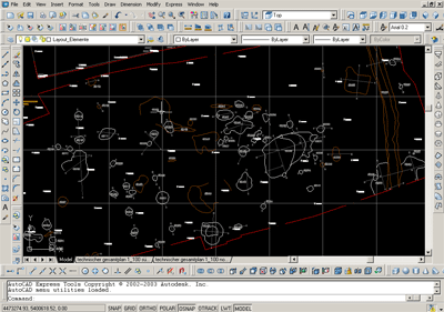
CAD works
Building on CAD experience since 1999 i can offer a wide range of 2D and 3D CAD services:
- Using Autodesk AutoCAD and Dassault Systèmes DraftSight
- Plan creation out of simple survey raw data
- Plan and map creation of various source data
- Plan and map layout
- Plan creation and management for excavations by standardised state regulations
- Digitizing of hand drawn plans and photogrammetry results
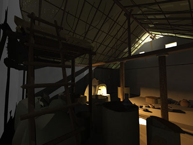
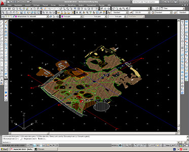
- Modelling of complex features from excavation documentation
- Reconstruction and structural analysis modelling
- Professional photo-realistic renderings
GIS Services
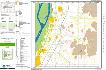
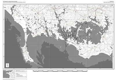
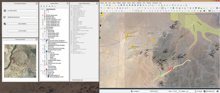
The use of Geographical Information Systems is almost a must have in every archaeological project these days mostly used for simple mapping tasks it can be used for a wide range of analysis. I use QGIS as an open source software solution which has a wide range of applications especially if combined with many user created add ons. My services in the field of GIS focus on mapping and visualisation. Many of the tasks are similar to what can be done in CAD:
- Plan creation out of simple survey raw data
- Plan and map creation of various source data
- Plan and map layout
- Digitizing of hand drawn plans and photogrammetry results
Services i offer which use possibilities unique to GIS are (amongst others):
- Set up of whole map sets to cover large areas geodetic correct using several different reference systems
- Advanced layout options using several versions of the same map in the same layout
- Atlas generation
- Terrain analysis (e.g. slope, visibility, watershed, flooding)
- Terrain visualisation (e.g. contour lines and shading)
- Base (topographic) map generation out of remote sensing data and variable data sources
- Connection of field or other databases with geographic information for spatial queries
- Spatial analysis using vector and raster data together with database queries
- Visualisation of Photo databases
- Visualisation of Aerial and other photogrammetry results
- Single image geo referencing
- Old plan and map geo referencing
- Implementing and geo referencing of Geophysical survey data
- Visualisation of geophysical survey data in combination with other data sources such as terrain or excavation results
stremke-archaeology provides customers with state of the art survey and documentation solutions for archaeological projects worldwide