
ROMAN GOLD MINING IN THE „KARTH“, EASTERN ALPS, AUSTRIA
Research project, financed by the Austria Science Fund (FWF, Project P 30790-G25)
Select language
Sprachauswahl


Archaeology
The archaeological research starts with extensive field walking based on features (reservoirs, leats) recognizable in LIDAR scans of the region. Known Roman sites in the wider area around the mining district will be mapped to put the mining area into the socio-economic context of the region. Archaeological excavations will be carried out yearly on sites selected according to the results of field walking and geophysical prospection (reservoirs, leats, potential settlement sites). The aim of these excavations is the reconstruction of the construction of the reservoirs, their volume and the construction of the sluice gates as well as gaining insights into the infrastructure necessary for this mining operation and the dating of individual sites.
The results of all disciplines involved in the project will be assessed in interdisciplinary discussions in order to gain as complete a picture as possible of this mining area and its environment.
The archaeological fieldwork of the first year of the project was quite successful. The field survey showed that the number of reservoirs is greater than we supposed at the beginning of the project.
A preliminary report on the archaeological research carried out in 2018 can be found here: Preliminary Report 2018
Report of field trip to Dolaucothi
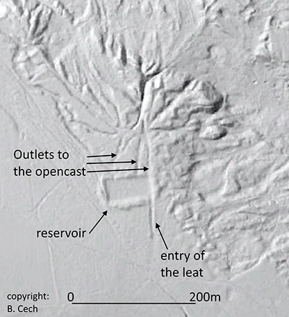
LIDAR scan of a reservoir. The inlet of the leat and the outlets leading to the opencasts are clearly visible.
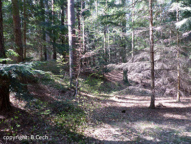
The inside of one of the newly found reservoirs.
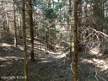
The outlet towards the opencast of one of the newly found reservoirs.
Univ.-Doz. Dr. Brigitte Cech
Selfemployed archaeologist, Wien
Habilitation for Mining- and Industrial Archaeology, University of Vienna
Contact:
